Shitamatchi Maps
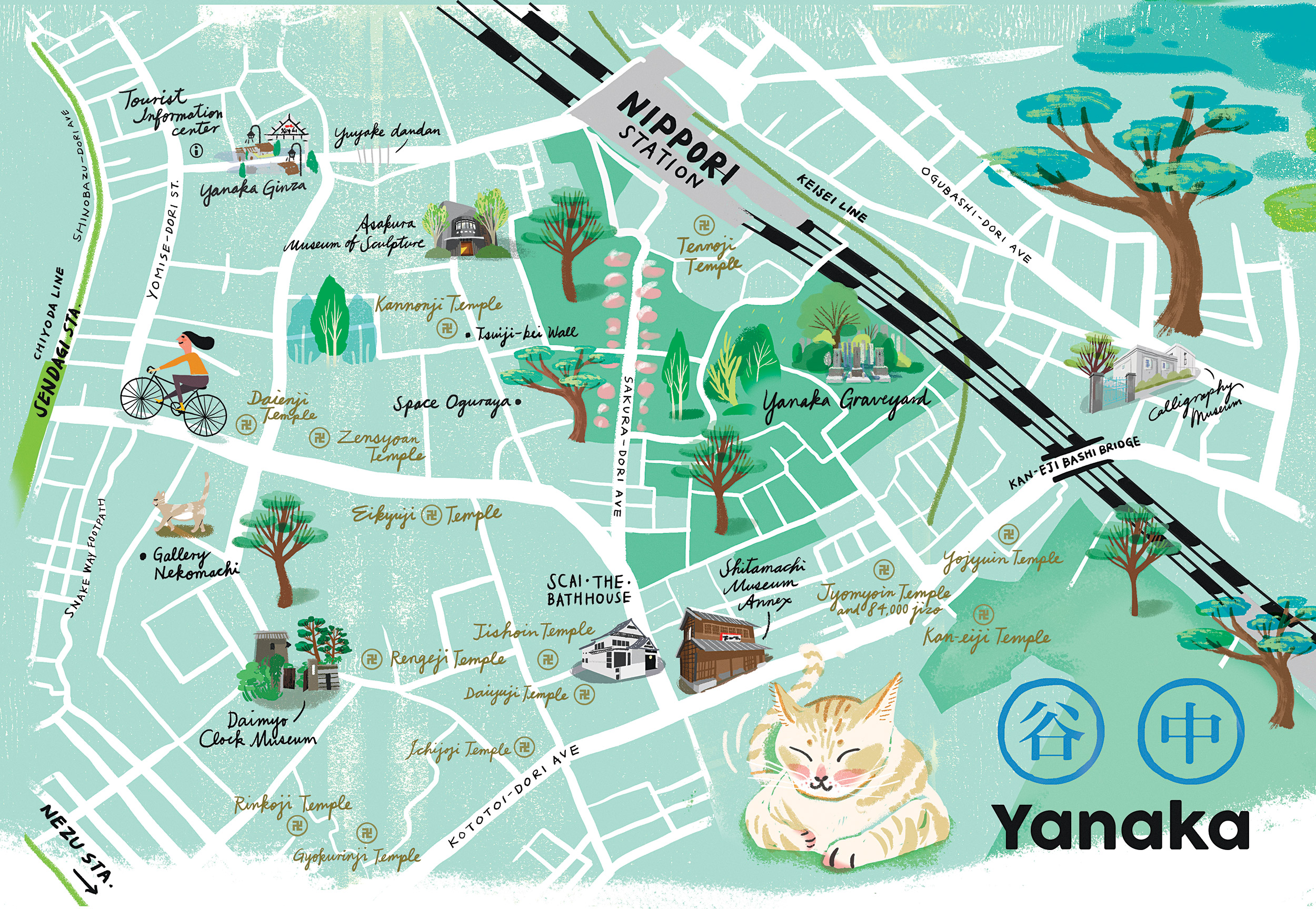
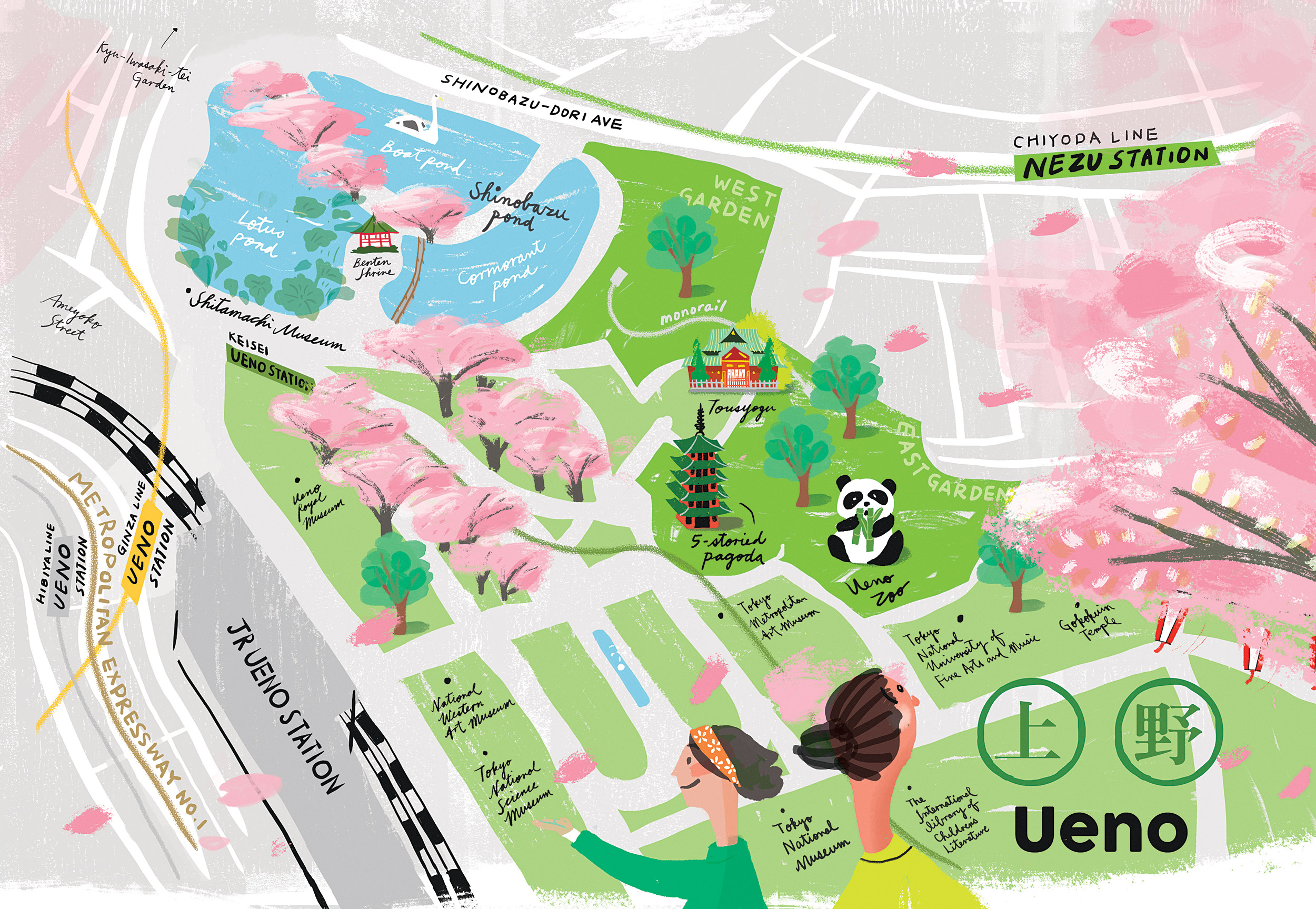
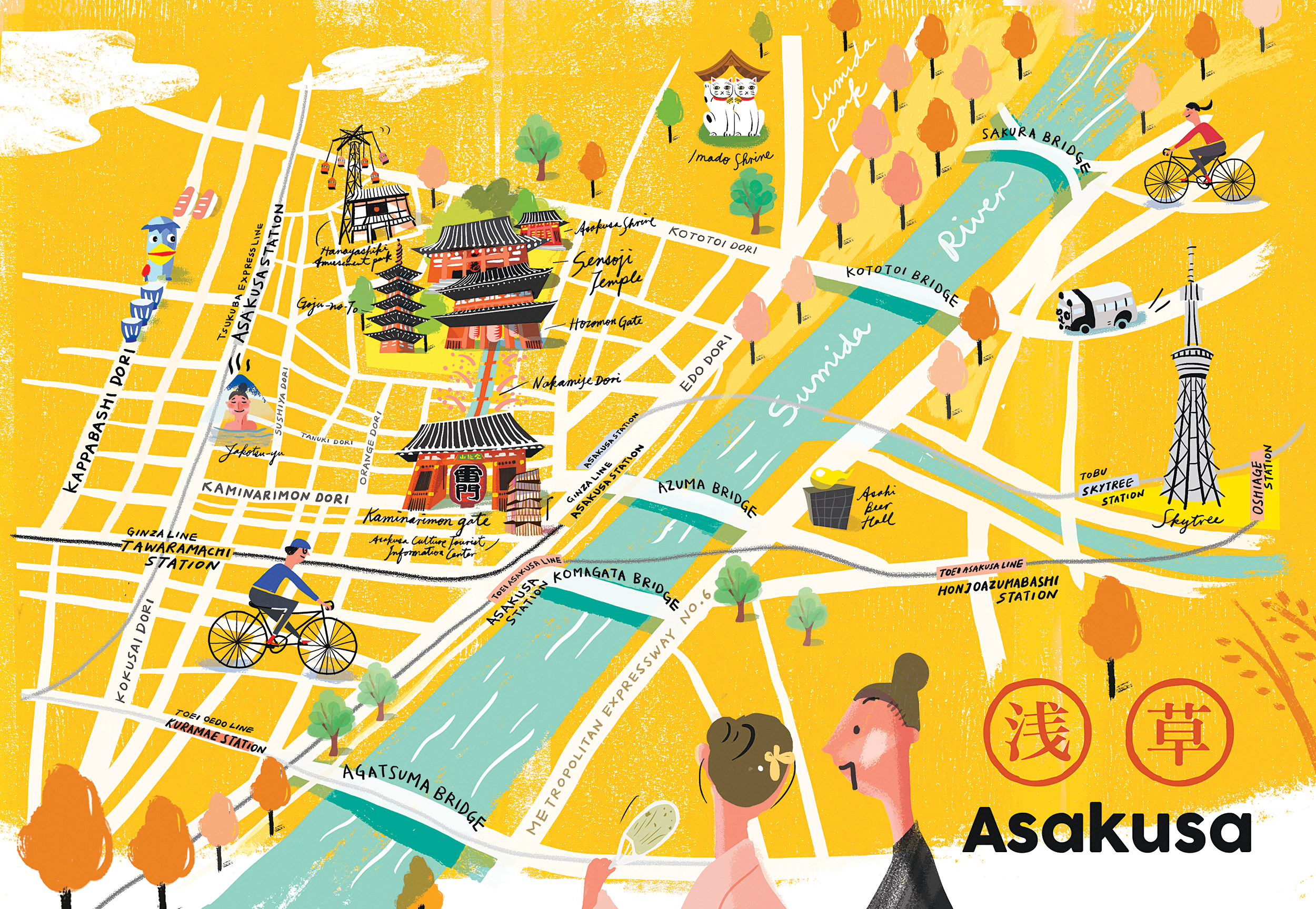
What’s it —— Shitamachi (下町) is the traditional name for the area of Tokyo including today the Adachi, Arakawa, Chiyoda (in part), Chūō, Edogawa, Kōtō, Sumida, and Taitō wards, the physically low part of the city along and east of the Sumida River. These maps are originally made for a publication indtroducing artisans in the Shitamachi areas.
Client
:
Kingyo Publishing
——
Graphic design & Illustration :
Studio TIO
Kingyo Publishing
——
Graphic design & Illustration :
Studio TIO